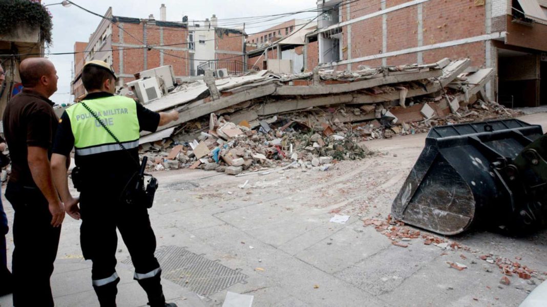
The entire province of Alicante, most of Valencia and four towns in Castellón, can suffer earthquakes ranging from “mildly damaging” to “destructive”.
The Region has seen 43 seismic movements so far this year.
The Region’s lands tremble, although, for the most part, these vibrations are so faint that they generally go unnoticed.
So far this year there have already been 43 seismic movements. The Community is located near the confluence of the Eurasian and African tectonic plates which is marked by three systems with active faults, the Betic, the Iberian and the Catalan coastal range.
This means that more than 4.4 million Valencians live in municipalities with seismic risk VI or higher, a scale that measures the damage caused by earthquakes.
The entire province of Alicante, almost all of Valencia, with the exception of eight towns, and four municipalities of Castellón, are all in the threatened area. Intensity VI on the European Macroseismic Scale (EMS) is equivalent to a “mildly harmful” grade. This means that small objects fall and that there is often slight damage to buildings, such as cracks in the plaster and some elements falling off.
Under this parameter there are four Castellón towns (Bejís, Xilxes, La Llosa and Moncofa), another five from Alicante (Benissa, Benitatxell, Calp, Gata de Gorgos and Senija), and 67 in the Valencia region, (including Alfara del Patriarca, Burjassot, Cheste, Llíria , Requena or Sagunto).

Above that level there are 327 municipalities in Alicante and Valencia where intensities could reach between VII and IX. Many buildings in these categories would suffer moderate damage. And in addition to small cracks, you could expect partial collapse of walls.
Level VIII is “severely damaging” and in this case buildings could partially collapse. The highest level that could be anticipated in the region is IX, or “destroyer.”
With that intensity monuments and columns would fall or suffer serious damage and some buildings could collapse completely. In the province of Alicante the towns and cities that are included in this last category include Torrevieja, Rojales, Benijófar, Orihuela and Elche.
However, the National Geographic Institute (IGN), emphasise that most of the seismic movements registered in the Region in the last half century are of a magnitude (quantification of the energy released by an earthquake) lower than 3. The most prominent have been around the 4.7 in Alicante and 4.5 in Valencia. Last year there were around 200 between the two provinces.
According to Luis Cabañas, seismologist from the National Seismic Network of the IGN, it is not possible to predict when the next earthquake will take place or its intensity. All that we can do it to continue to collect as much data as possible to try to prevent their effects.
Meanwhile, Francisco García, professor of Geophysics at the Polytechnic University of Valencia, highlights that the seismic risk in the region is “between low and moderate.”
Under the ground “there are more failures than people imagine.” But the country has “one of the best seismic networks” to detect what is happening, at all times, he adds, “with great coverage of the Valencian Community.” The data it provides allows us to study the internal structure of the earth and what faults are like, in order to develop seismic engineering models that are then used to “build better and save lives.”
The region has suffered a number of major earthquakes. The one of 1048 in Orihuela, with intensity VIII, destroyed the mosque. About 200 houses were lost in Tavernes in the earthquake of December 1396. In this case the strength ranged between VIII and IX.
Many houses also collapsed in Muro de Alcoy in 1644. The earthquake of Estubeny in March 1748 destroyed that town as well as those of Montesa and Sellent. Torrevieja and Guardamar had to be completely rebuilt after the shock of March 1829, of intensity IX-X. Almost 3,000 buildings were destroyed with nearly 400 deaths.


